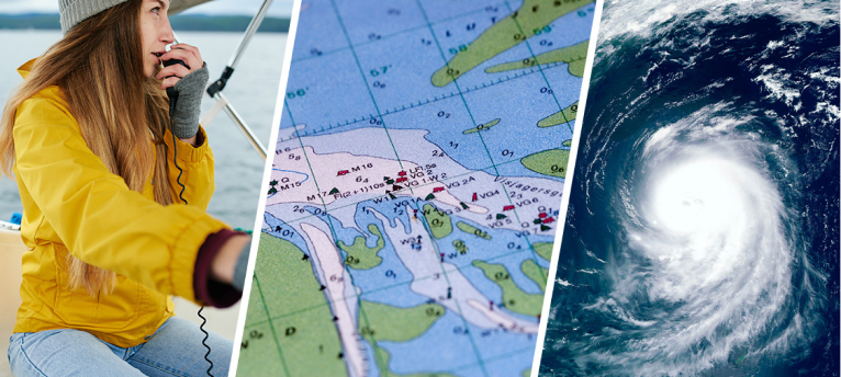
Features
Weather forecast for an entire region, emailed to you daily (except Sundays).
Plain text forecast with no images, links, or downloadable content.
East Caribbean (E of 72W)
West Caribbean (W of 72W)
Bahamas & Florida
US East Coast (as far N as New England and Nova Scotia in the summer)
Sufficient detail to help you make weather-related decisions, and may offer insights we don't have time for on SSB Nets. Regional Email forecasts focus on coastal / cruising areas, and are NOT intended for use while offshore passagemaking.
Regional Emails include the following:
- Satellite wind observations from the past 12 hours
- Recent buoy observations
- Satellite & radar imagery summary
- Synopsis of significant weather features
- An outlook, if applicable
- Specific 5-day forecasts for the following parameters at various spots (breakdown of spots varies, with finer detail when warranted) in popular Cruising grounds:
- Precipitation, including a wind-velocity estimate ("squalls to 40k" means squalls with total wind to 40k) and coverage estimate (stray, isolated, scattered or numerous).
- Wind direction and velocity (forecast trends are vitally important and will be highlighted in the forecast)
- Seas, including height, direction, and interval of wind-driven waves and significant swells, if applicable.
- Suggestions when appropriate
ALL Regions include details on all Tropical weather events.
SAMPLE REGIONAL FORECASTS
ASCAT 9PM Tue6: Samana WSW@4-8k; MonaPsg L&V; S PR SW@3-6k; VIs S@5-9k; E Bonaire ENE@10-14k
BUOYS: Ponce N@4-6k; 1-2'/6secSSE / Vieques Sound SW@4-6g10k; 3'/9secN / S of StJohn SSW@4-6g8k; 2'/5secSSE / 40miSW of Nevis unknown direction at 8g10k; 2'/9secE / StLuciaAirport Variable mostly E-SE@5-12k
IMAGERY: Scattered squalls are moving W across the VIs-PR with thunderstorms farther W along S DR. Squalls are moving W across the Windwards with higher coverage S of StLucia although a small cluster of thunderstorms is along the NE tip of Guadeloupe with a few squalls also moving W off Martinique.
SYNOPSIS:
Hurricane Earl continues to move slowly N along 65 W away from Hispaniola and the N Caribbean. Mild SE-SW wind remains across the VIs-PR towards the Leewards as wind gets wrapped into the system. Light wind from various directions persists across Hispaniola today-Thu8 as the region remains S of Earl.
Southerly flow along with moisture from the periphery of Earl will continue to fuel squalls and thunderstorms across the N half of the region through Fri9-Sat10. Squalls will remain sporadic in nature, with some areas remaining mostly dry, while other areas will continue to have higher coverage. The pockets of more persistent squalls will move around each day, but will primarily remain near PR-VIs towards the Leewards and N Windwards.
As Earl continues moving N, the influence of the system on the Caribbean diminishes by late Thu8-Fri9, allowing more typical E trades to gradually redevelop across the region. Wind is most persistent in the S Windwards from today throughout the weekend. Wind will remain mild across the N half of the region Fri9-Sat10 as Earl continues to block trade winds.
A slightly elevated northerly swell emanating from Earl will remain along the N side of Hispaniola towards PR-VIs today, with seas gradually diminishing Thu8 onward.
OUTLOOK:
A Tropical WAVE that is W of Cape Verde has a higher potential of developing throughout this week, but will be pulled well N&E of the Caribbean. The focus then turns towards the next WAVE moving off Africa around Thu8-Fri9. Given the atmospheric setup, this WAVE has a higher chance of remaining far enough S to impact the Caribbean. If this wave strengthens and becomes more organized quickly, then it could turn N ahead of impacting the Caribbean, but if it remains weak and develops more slowly, then it may move W through the Caribbean during the middle of next week, around Wed14-Sun18. If it does move through the Caribbean next week, it is more likely to impact the N half of the region.
SUGGEST:
Trinidad-Guadeloupe: N bound remains favored today, but travel is likely salty due to squalls. N bound sailing remains favored Thu8-Sat10 with squalls lingering in the area. S bound is not ideal, but motoring with light wind is possible Thu8-Fri9. A mix of motoring and sailing in either direction is possible Sat10-Sun11, with squalls more likely farther S.
Antigua-StMartin: NW bound sailing is favored today, becoming salty at times due to occasional squalls. A few squalls continue with NW bound remaining favored, although mild wind allows for motoring in any direction Thu8-Fri9. NW bound sailing favored Sat10-Sun11 amidst a few squalls, with SE bound travel becoming more difficult.
AnegadaPsg-PR: Wind allows for travel in either direction today-Fri9, with motoring or motor-sailing becoming salty at times due to squalls. Wind favors W bound travel Sat10-Sun11 amidst fewer squalls.
MonaPsg-DR: Mostly mild motoring in any direction today-midday Fri9. W bound sailing becomes favored Fri9 evening-Sun11. Squalls are more persistent along the MonaPsg, resulting in salty travel at times.
PRECIP (Coverage is highest overnights into mornings):
Trinidad-Guadeloupe: Isolated-Scattered to 30k today-Fri9; Isolated to 30k Sat10-Sun11.
Antigua-StMartin: Isolated<Scattered to 30k today; Isolated to 30k Thu8; Isolated-Scattered to 30k Fri9; Stray-Isolated to 30k Sat10; Stray to 30k Sun11.
VIs-PR: Scattered to 30k today; Isolated<Scattered to 30k Thu8; Isolated to 30k Fri9; Scattered<Isolated to 30k Sat10-Sun11.
MonaPsg: Isolated to 30k today-Fri9 (highest coverage overnights); Isolated-Scattered to 30k Sat10-Sun11.
DR: Stray-Isolated to 30k today-Sun11 (highest coverage mornings-afternoons).
ABCs: Stray-Isolated to 30k today; Isolated<Scattered to 30k tonight-Fri9; Stray-Isolated to 30k Sat10; Isolated to 30k (highest coverage late nights-mornings)...NOTE: Wind reversal (W-component wind) is not likely, but given increased squalls and variable wind, a wind-reversal event cannot be ruled out Thu8.
WIND:
Trinidad-StLucia: SE-SSE@7-17g21k/2-5' today-Thu8; SE<E-ESE@7-16g20k/2-4' Thu8 night-Fri9; ESE<ENE-E@8-15g20k/2-4' Sat10-Sun11.
Martinique-Guadeloupe: SE-S up to 15k/1-4' today-Thu8; SE-S<E-ESE up to 16k/2-4' Thu8 night-Fri9; E-ESE@7-16g21k/2-4' Fri9 night-Sat10; E-ESE under 15k/2-4' Sun11.
Antigua-StMartin: SE-SSW up to 12g15k/1-3' (closest to SSW near StMartin) today; SE-S up to 12k/1-3' Thu8; SE<E-ESE under 12k/1-3' Fri9; E-SE@6-14g18k/2-4' Fri9 night-Sun11.
VIs-E PR-AnegadaPsg: SSE-SW under 15k/1-4' today-Thu8; SE-S<E-ESE up to 12k/1-3' Fri9; E-SE@6-15g19k/2-4' Sat10; E-ESE up to 12k/1-3' Sun11.
PR S Coast: SE-SW up to 12k/1-3' today; SE-S under 12k/1-3' Thu8; E-SE up to 12g15k/1-3' Fri9; ENE-SE up to 15k<up to 12k/1-3' Sat10-Sun11.
MonaPsg: Variable mainly SE-SW up to 15k/1-4' today-Thu8; SE<E-ESE up to 15k/2-4' Fri9; ENE-SE up to 12k<up to 16k/2-4' Sat10; ENE-ESE up to 12g15k/2-4' Sun11.
E DR: Variable mostly WSW-NW under 12k/2-3' today; Variable up to 10k<E-S up to 15k/1-3'<2-4' Thu8; Variable mostly SE-S up to 12k<E-ESE up to 16k/1-3'<2-4' Fri9; ENE-ESE@5-14g17k/2-3' Sat10; ENE-ESE up to 12k/1-3' Sun11.
W DR: Variable mostly W-N under 14k/1-3' today; L&V/1-2' Thu8; Variable mostly SE-S up to 12k<E-ESE up to 16k/1-3'<2-4' Fri9; ENE-ESE@8-20g25k/3-6' Fri9 night-Sat10; ENE-ESE under 18k/2-5' Sun11.
ABCs: E-SE@8-17g22k<ENE-E up to 15g20k/2-5' today; Variable mostly E-SE@5-17g22k/2-5' (potential for wind-reversal in stronger squalls) Thu8; SE<ENE-E@8-20g25k/3-6' Fri9; ENE-ESE@15-23g27k/5-7' Sat10; ENE-ESE@12-21g26k/3-6' Sun11.
SWELLS:
Trinidad-Guadeloupe: 2-4'/9-12secNE-E today; 2-4'/8-11secN-ENE Thu8-Fri9; 3-5'/11-14secNNE-NE<9-12secNE Sat10-Sun11.
Antigua-StMartin: 2-4'/9-11secN-NE today; 2-5'/9-11secN-NNE<10-13secNE Thu8-Sun11.
AnegadaPsg-VIs: 2-4'/10secN today-Fri9; 3-5'<2-4'/10-13secN-NE Sat10-Sun11.
MonaPsg-DR: 3-6'/10secNNE today; 3-5'<2-4'/10secNNE-NE tonight-Thu8; 2-4'/9-13secNNE-NE Fri9-Sun11.
ABCs-Venezuela: Mostly wind-chop today onward.
ASCAT 10PM Mon12: Mexico ENE-E@10-15k; Belize ENE-E@12-18k; Bay Islands ENE-E@15-20k; Jamaica E-ESE under 10k
IMAGERY: Squalls are scattered across Jamaica toward the Caymans and much of the interior portions of the W Caribbean. Squalls are also drifting along the Coast of N Belize and S Mexico. Numerous squalls are moving W off W Panama toward S Nicaragua (mainly dry near P-S-A).
SYNOPSIS:
Mexico: A weak pressure gradient results in mild, variable ENE-SE wind today. Squalls increase by tonight with sporadic squalls continuing Wed14-Fri16. More persistent E-SE trades arrive Wed14-Thu15. Then, wind backs toward ENE-ESE late Fri16-Sat17 due to the tropical wave moving across the E Caribbean. Squalls likely decrease in coverage Sat17-Sun18.
N-C Belize: Mild ENE-SE wind today builds slightly Wed14. Moderate ENE-ESE trades continue Thu15-Sat17. Typical scattered squalls continue indefinitely, mainly overnights-mornings.
BayIslHonduras: Diurnal winds are suppressed today, then become brisk Wed14 onward with typical squalls likely overnights-mornings.
SW Corner of NW Caribbean: Normal diurnal pattern continues indefinitely with ongoing squalls each night-morning.
P-S-A: ENE-ESE trades are mild today, then trades build along with increasing squalls as broad TROF moves overhead Wed14-Fri16. Trades abate Sat17-Sun18 with ongoing or slightly decreased squalls.
W Panama: Wind remains light and variable with occasional squalls, generally occurring late nights-middays.
C-E Panama: Wind is light and variable with occasional squalls, mainly nights-mornings.
Colombia: Gradient wind is mild today, then NE-E trades increase Wed14-Thu15 before the next interval of lighter and more variable conditions return Fri16-Sun18. Wind direction may be mostly S-SW, paralleling the Colombian coast this weekend. Squalls remain problematic indefinitely with most coverage overnights-mornings.
NE Jamaica: Mild E-SE wind today builds tonight-Wed14 along with squalls due to an upper level disturbance. Milder winds return Thu15-Fri16 with drier weather. The next wave likely increases squalls again Sat17-Sun18 with highly variable (mostly mild) wind.
SE Jamaica: Mild E-SE wind today builds tonight-Wed14 along with squalls triggered by an upper level disturbance. Trades remain brisk from E Thu15, then NE-ESE wind is milder Fri16 amidst drier weather. The next wave likely increases squalls again Sat17-Sun18 with highly variable (mostly mild) wind.
Caymans: Mostly mild E-SE winds today amidst increasing squall coverage. Squalls linger Wed14 before decreasing Thu15. Wind is light from E-SE Wed14, then builds while backing toward ENE Thu15-Fri16 ahead of the next system. Mild to moderate ENE-E trades continue Sat17-Sun18 with squalls increasing Sun8
CayoLargo: Wind is mild and variable from NE-SE today with increasing squalls along a weak disturbance. Squalls continue Wed14 before decreasing Thu15 amidst mostly E-SE wind. Typical NE-E diurnal winds likely return Fri16-Sun18 with low-end squall coverage.
Jardines Cuba: Wind is light from NE-SE today with occasional squalls along a weak disturbance. Squalls continue Wed14 before decreasing Thu15 amidst mostly E-S wind. Typical NE-E diurnal winds likely return Fri16-Sun18 with low-end squall coverage.
FORECAST:
PRECIP:
Mexico: Stray<Isolated to 30k today; Isolated to 30k Wed14-Fri16; Stray to 30k Sat17.
N-C Belize: Scattered to 30k today-Sat17…mainly overnights-mornings.
BayIsl/Hond: Isolated-scattered to 30k today-Sat17…mainly overnights-mornings.
P-S-A: Isolated to 30k today-Wed14; Scattered or numerous to 30k Thu15-Sat17.
W Panama: Scattered to 30k today-Sat17…mainly late nights-middays
C&E Panama: Scattered to 30k today-Sat17…highest coverage nights-mornings.
Off Colombia: Scattered to 35k today-Sat17…highest coverage evenings-mornings.
WIND (for wind in squalls see PRECIP):
Mexico: Variable mainly ENE-SE up to 12g15k today; E-SE@7-15g18k Wed14-Fri16; E-SE<ENE-ESE@8-16g20k Fri16 night-Sat17.
N-C Belize: ENE-SE under 15k today; ENE-ESE@10-18g23k Wed14-Sat17
S Belize (Placencia-RioDulce): L&V nights-mornings / NE-E up to 15k afternoon-evenings today-Sat17.
BayIsl/Honduras:
Near Utila-W Roatan: Variable under 10k<NE-E@10-18g23k this afternoon-evening; then diurnal pattern with Variable under 12k mornings / ENE-E@12-20g25k afternoon-evenings Wed14-Sat17.
Near E Roatan-Guanaja: ENE-E@12-18g23k this afternoon-evening; then diurnal pattern with SE up to 15k mornings / ENE-E@15-22g27k afternoon-evenings Wed14-Sat17.
P-S-A: ENE-SE@7-15g18k today; ENE-ESE@7-17g22k Wed14-Fri16; Variable mostly NE-ESE under 15k Sat17.
W Panama: L&V today-Fri16; L&V, mostly SW-NW Sat17.
C-E Panama: L&V today-Fri16; L&V, mostly S-SW Sat17.
Colombia, near 75W: Variable under 15k today; NE-E up to 20k Wed14; NE-E up to 25k Wed14 night / Variable under 15k Thu15; NE-E up to 25k Thu15 night; Variable under 12k Fri16; Variable mostly S-SW under 15k Sat17.
SEAS:
NW Caribbean N of 19N: 1-3'/4-7secE-SE today-Wed14; 2-3'<3-5'/6secSE Wed14 night-Fri16; 2-4'/5-7secE-SE Sat17.
NW Caribbean S of 19N: 2-5'/6-9secE-SE today; 3-6'/5secE-ESE Wed14-Fri16; 3-5'/5secE Sat17.
Just E of P-S-A: 3-4'/6secENE-E today; 3-5'/6secENE-E Wed14-Thu15; 3-6'/6secENE-E Fri16; 3-5'/6secENE Sat17.
Off W Panama: 1-3'/6-9secNE today-Thu15; 2-4'/6-9secNE Fri16-Sat17.
Off C-E Panama: 1-3'/6secNE today; 2-4'/5-9secNE (highest C Panama) Wed14-Sat17.
OTHER AREAS:
NE Jamaica: E-SE up to 12k<10-18g23k today; SE@10-20g25k Wed14; Variable NE-ESE under 12k Thu15-Fri16; Variable mostly N-E under 10k Sat17…Scattered to 30k today-Wed14; Stray to 30k Thu15-Fri16; Stray<Isolated to 30k Sat17.
SE Jamaica: E-ESE@7-15g18k today; E-SE@10-20g25k tonight-Wed14; ENE-ESE@12-20g25k Thu16; NE-ESE up to 15k Thu15 night-Fri16; Variable mostly NE-ESE under 12k Sat17…Scattered to 30k today-Wed14; Stray to 30k Thu15-Fri16; Stray<Isolated to 30k Sat17.
Caymans: Mostly SE under 15k today; SE@5-17g22k tonight-Wed14; E-SE@7-17g22k Thu15; E-SE<ENE@8-17g21k Thu15 night-Fri16; ENE-E@8-17g22k Sat17…Scattered to 30k today-Wed14; Stray to 30k Thu15-Sat17.
Cuba's Coast CayoLargo: Variable mainly NE-SE under 12k today; Mostly SE up to 17g21k Wed14-Thu15; Diurnal pattern with L&V days / NE-E@8-17g22k nights Fri16-Sat17…Isolated to 30k today; Scattered to 30k tonight-Thu15; Stray to 30k Fri16-Sat17.
Jardines & TrinidadDeCuba: Variable mainly NE-SE up to 12k today; then Variable E-S up to 15k Wed14-Thu15; Diurnal pattern with Variable under 10k days / NE-E@10-20g25k nights Fri16-Sat17…Scattered to 30k today-Wed14; Scattered<Stray under 30k Thu15; Stray to 30k Fri16-Sat17.
ASCAT 12PM/Mon12: KeyWest ESE@7-10k / Miami ESE@5-8k / Canaveral NW@2-5k / Wend E@2-5k / Nassau Variable up to 5k / S Andros E@3-6k
BUOYS: Wend N@2-4g6k / FwyRocks ESE@7-8g10k / LkWorth ESE@5-8g9k / Canaveral SW@4-6g8k; 4’/11secENE
IMAGERY: Large cluster of squalls across the FL BigBend area, bringing continuous squalls along the coast from S of Panama City to Tampa. More squalls in SW FL, highest coverage just SW of CpCoral. Isolated strong squalls along KeyWest. Squall line inland along NFL approaching the FL E Coast, moving offshore within the next hour or so. Isolated squalls across the Bahamas.
SYNOPSIS:
The TROF spread across FL last week continues to linger today, causing an increase of squalls along FL and the NW Bahamas. The TROF will combine with a FRONT moving SE across the US towards FL on Tue13. The FRONT will ultimately stall somewhere along the FL peninsula, likely CFL, around Wed14. This will further enhance squall coverage across FL and the NW&C Bahamas Tue13-Fri16. Relatively drier conditions across the SE Bahamas this week, though Tue13-Wed14 likely see a slight increase in squalls.
Winds continue to be mild across the region today-Tue13. Rebuilding of E-SE wind across the C&SE Bahamas occurs Wed14-Fri16 as RIDGE strengthens, increasing the gradient wind. Milder and more variable wind persists throughout FL and NW Bahamas generally, as the TROF/Frontal Boundary settles across FL. Some stronger NE wind is possible along NFL Thu15-Fri16, behind the FRONT, enhanced by a surface LO that is expected to form along the FRONT.
Swell emanating from Post-Tropical Cyclone Earl most notably effects the Bahamas today-Wed14, with some effects to the FL E Coast. Swells up to 8’ are possible along the Bahamas, mainly Tue13. FL is likely to experience up to 6’ swells. Wed14 onward, seas gradually settle.
OUTLOOK:
The TROF/Frontal Boundary is likely to persist across FL into next week, continuing to support an increase in squalls across FL and NW&C Bahamas. Wind becomes slightly more rebuilt across FL this weekend into next week, while still remaining relatively mild.
Some guidance suggests that the potential surface LO that may form this weekend into next week, could ultimately take on tropical characteristics while heading northward. Exact details aren’t clear or confident at this time, being that this potential LO is nearly 10 days out. We will continue to monitor any possible development.
PRECIP: (highest coverage usually overnights into mornings)
NW Bahamas-Abaco: Isolated to 30k today; Isolated<Scattered to 35k Tue13; Scattered-Numerous to 35k Wed14; Isolated<Scattered to 35k Thu15; Isolated to 30k Fri16.
N Exumas-Nassau-N Andros-Eleuthera: Isolated to 30k today; Scattered to 35k Tue13-Wed14; Isolated<Scattered to 35k Thu15; Stray-Isolated to 30k Fri16.
S Exumas-GeorgeTown-Conception-Rum: Isolated to 30k today; Isolated-Scattered to 30-35k Tue13-Wed14; Isolated to 30-35k Thu15; Stray-Isolated to 30k Fri16.
SE Bahamas-Raggeds-Acklins-Mayaguana-Inagua: Stray to 25k today; Isolated-Scattered to 30-35k Tue13; Isolated-Scattered<Stray to 30k Wed14; Stray to 25k Thu15-Fri16.
WIND: (For wind in squalls see PRECIP):
NW Bahamas (GrandBahama-Abaco): Variable mainly NE-E under 10k today; Variable mainly ENE-SE under 12g15k Tue13; Variable mainly SE-SW up to 14g18k Wed14-Thu15; Variable mainly SE up to 14k Fri16.
N Part of C Bahamas (NE ProvChnl-Eleuthera-N Exumas-Nassau-Berrys-GrtBahamaBk): Variable mainly NE-E up to 12g15k today; Variable mainly NE-S under 15k Tue13; SE-SSW up to 16k Wed14; SE-S up to 15g19k Thu15; E-SE up to 16k Fri16.
S Part of C Bahamas (in this case from StanielCay area and CatIsland S-ward to N Long Isl): Variable mainly NE-E up to 12g15k today; Variable mainly E-SSE under 12k<up to 16g20k Tue13; SE-S@7-18g22k Wed14; Variable mainly E-SE@7-15g18k Thu15; E-SE@8-16g20k Fri16.
Jumentos-S LongIsland-Acklins-Mayaguana: Variable mainly NE-SE under 14k today; Variable mainly ESE-SE@7-15g19k Tue13; ESE-SSE@8-18g23k Wed14; ESE-SE@10-18g23k Thu15; ENE-E@10-20g25k Thu15 night-Fri16.
T&C S&E closer to Luperon: Variable mainly ENE-SE up to 14k<up to 18k today; ESE-SE@8-18g23k Tue13; E-SE@12-22g27k Wed14; ENE-ESE@14-25g31k Thu15-Fri16.
SEAS (Atlantic side of Bahamas):
NW Bahamas: 4-6’<5-7’/10-13secNE today; 5-8'<5-7/12-14secNE Tue13; 3-6'<3-5’/11-13secNE Wed14; 3-5’<1-3’/8-12secENE-E Thu15-Fri16.
C Bahamas: 3-6’<4-7’/9-13secNE today; 5-8'<4-7’/12-14secNE Tue13; 4-7'<4-6’/11-14secNE Wed14; 3-5’<1-4’/8-12secNE<E Thu15-Fri16.
SE Bahamas: 3-6’<5-7’/10-13secNE today; 5-8'<4-7’/12-15secNE Tue13; 4-7'<3-6’/11-14secNE Wed14; 3-6’<2-5’/8-12secNE<E Thu15-Fri16.
CROSSINGS: Relatively mild winds today-Thu15, supporting travel in either direction. Mainly easterly wind rebuilds slightly Fri16, favoring W bound travel. A lingering TROF continues to be situated across FL, bringing increased squall coverage today. Squall coverage will gradually increase as the week goes on, due to a FRONT approaching Tue13. The FRONT is expected to stall along FL later this week, just N of the crossings. Today is likely the best day for travel, in the midst of potentially the driest conditions of the week. Conditions become saltier as the week goes on, with some occasional breaks in the squalls.
N ROUTE: Variable mainly ENE-ESE under 10k/0-2’ today; L&V<Variable mainly E-SE up to 10k/0-2’<1-2' Tue13; Variable mainly ENE-ESE up to 12k/1-3' Wed14; Variable mainly E-S up to 12k/1-3’ Thu15; Variable mainly ESE-SE up to 14k/1-3’ Fri16…Stray to 30k today; Isolated-Scattered to 30-35k Tue13; Scattered-Numerous to 30-40k Tue13 night-Wed14; Scattered to 35k Thu15; Isolated-Scattered to 30k Fri16.
S ROUTE: Variable mainly ENE-ESE under 10k/0-2’ today; L&V<Variable mainly ENE-ESE up to 10k/1-3' Tue13; Variable mainly E-S up to 12k/1-3’ Wed14; Variable mainly ESE-SSW up to 12k/1-3’ Thu15; Variable mainly ESE-S up to 14k/1-3’ Fri16…Stray to 30k today; Stray<Isolated-Scattered to 35k Tue13; Scattered-Numerous to 30-40k Tue13 night-Wed14; Stray<Isolated-Scattered to 30-35k Thu15; Isolated to 30-35k Fri16.
OTHER AREAS:
SW FL (between KeyWest and FtMyers): L&V/0-2’ today; L&V<Variable up to 14k/0-2’<1-3' Tue13; Variable mainly NE-E up to 13g16k/1-3' Wed14; Variable up to 12k/1-3’ Thu15; Variable mainly E-S up to 15g18k/2-4’ Fri16…Isolated-Scattered to 30-35k today-Tue13; Scattered to 30-35k Wed14-Thu15; Isolated<Scattered-Numerous Fri16.
Lower FLKeys-KeyWest: Variable mainly N-SE up to 10g14k/1-3’ today; L&V mainly ENE-SE/0-2’ Tue13; Variable mainly ENE-SE up to 10k/1-2' Wed14; Variable mainly E-S up to 12k/1-3’ Thu15; Variable mainly E-SE under 12k<up to 14g17k/1-3’ Fri16…Isolated to 35k today-Tue13; Scattered to 35k Wed14; Isolated-Scattered to 30k Thu15-Fri16.
CFL: L&V<Variable mainly S-SW up to 10k/1-2’ today; L&V<SE up to 14k/0-2’<1-3' Tue13; Variable mainly N-E up to 14k/2-3' Wed14; Variable up to 12g15k/1-3’ Thu15; L&V/0-2’ Fri16...Stray<Isolated to 30k today; Isolated to 30-35k Tue13; Scattered-Numerous to 35-40k Wed14-Thu15; Scattered to 30-35k Fri16.
NFL: Variable mainly SSE-SW up to 14g17k/2-3' today; Variable mainly SW-W up to 16g20k<under 12k/1-3' Tue13; Variable up to 14k/2-3' Wed14; NE-ENE up to 14k/2-3’ Thu15; NE-E up to 22k/4-7’ Fri16…Strongest further N…Stray<Scattered to 30-40k today; Isolated to 30-35k Tue13; Scattered to 30-35k Wed14; Scattered<Isolated to 30-35k Thu15; Isolated<Scattered to 30-35k Fri16.
IMAGERY: A cluster of showers and squalls is drifting slowly along the GA/SC Coast. Dry along NC with a few clouds. Dry and fair N of Hatteras through New England.
SYNOPSIS:
NewEngland-N of CpMay: A HI shifts S from Maine this morning to Long Island this evening, allowing NE-E wind to abate along NJ/NY with L&V wind N of Cape Cod today. The HI moves farther off the Mid-Atlantic Sat10, supporting W-component wind from NJ to Cape Cod. The next approaching front builds southerly winds Sun11-Mon12 along NJ/NY. Wind is less consistent N of Cape Cod, with mostly SW-W wind Sun11-Mon12. Dry weather prevails today-Sun11, then showers and squalls likely move offshore Sun11 night-Mon12. Ongoing squalls accompany the front as it moves offshore Tue13. Mostly S-SW wind veers to W-NW behind the front Tue13 or Wed14 with dry weather returning Wed14. A swell associated with Hurricane Earl affects the area for the next several days. Swells are highest in offshore waters and near Nova Scotia (up to 12'). For the NE US, swells reach up to 8' from a lengthy 10-14sec interval.
CpMay-N of Hatteras: Brisk NE wind gradually settles and veers toward E today on the backside of the frontal TROF. Wind continues to abate and veer to SE Sat10 due to a HI off the Mid-Atlantic. Wind veers toward S and builds Sun11 as the next front approaches. Mostly dry weather prevails today-Sat10, then rain becomes increasingly likely Sun11 ahead of the front. The front is very slow moving (a result of a cut-off low in the Midwest), causing showers/squalls to slowly spread E in multiple rounds Sun11-Mon12. The last round of showers/squalls moves offshore Tue13 with the front. Mostly S-SW wind Tue13 veers toward NW-N behind the front Tue13 night-Wed14. Elevated seas up to 9’ (highest offshore) linger behind the frontal TROF today. Then, the swell associated with Hurricane Earl affects the area. Swells as high as 6’ are possible Sat10-Mon12 from a lengthy 10-14sec interval.
Hatteras-StMarys: The stalled frontal TROF along GA triggers squalls in GA/SC today. Brisk NE-E wind funnels down the SE US today. The upper level TROF in the Deep South lifts N Sat10-Sun11, allowing squalls to spread across the entire SE US with veering NE-E<SE-SW wind. Veering wind is strongest N of the remnant TROF, mainly N of Charleston. Mostly S-SW wind Mon12-Tue13 precedes the next cold front amidst ongoing squalls. Drier weather may arrive Wed14 behind the front, but this is dependent on the location of the front as it stalls along or just offshore the SE US. Elevated seas up to 10’ near Hatteras are possible today-Sat11 with influence from the TROF and Hurricane Earl, then the swell gradually decreases Sun12-Tue15. The swell reaches 6' off the rest of the SE US, highest in offshore waters.
OUTLOOK:
The front exiting the E US Tue13-Wed14 likely stalls along or just offshore the SE US. If the front is close enough to the coast, an active, wet pattern may continue for the SE US into the end of next week. Dry weather is likely to dominate N of Hatteras Wed14-Fri16 as N-component wind behind the front collapses, then southerly flow develops again ahead of the next front at the end of the week. There are no imminent tropical threats to the E US. Generally speaking, the main areas to watch this time of year are the Main Development Region (MDR) between Africa and the Caribbean and along stalled fronts from the Gulf of Mexico to the W Atlantic.
SUGGEST (Assuming S bound):
NovaScotia-Maine-N of CpCod: Mild motoring today. Motoring is a bit adverse Sat10. A mix of motoring and sailing Sun11. S bound travel is likely inclement Mon12-Tue13 with adverse wind and increasing squalls. Sailing possible behind the front Wed14.
CpCod-BlockIsland-CpMay: Fair sailing, then motoring today. Mild motoring Sat10, then adverse conditions develop for S bound Sat10 evening-Sun11. Inclement Mon12-Tue13 with the next S bound window opening Wed14.
CpMay-Norfolk: Increasingly milder S bound sailing today. A mix of sailing and motoring Sat10, then adverse for S bound Sat10 night-Sun11. Inclement Mon12-Tue13, then the next S bound sailing window opens Wed14.
Norfolk-Hatteras-CpLookout: Moderate to brisk S bound sailing today-Sat10. Vessels should aim to be S of Hatteras by noon Sat10 with the potential for squalls near CpLookout Sat10. Inclement Sat10 night-Tue13. The next S bound window may open Wed14-Thu15.
CpLookout-Charleston-StMarys: Inclement due to squalls today-Tue13. A mix of motoring and sailing possible Wed14, but dependent on the location of the front.
PRECIP:
NovaScotia-Maine-N of CpCod: Dry today-Sun11; Stray showers, mainly near CpCod Mon12; Scattered to 30k Tue13.
CpCod-BlockIsland-CpMay: Dry today-Sun11; Scattered to 35k Sun11 night-Tue13.
CpMay-Norfolk: Dry today-Sat10; Stray<Scattered to 35k (initially in the Chesapeake) Sun11; Scattered to 35k Mon12-Tue13.
Norfolk-N of Hatteras: Stray showers today; Dry Sat10-Sun11; Scattered to 35k Sun11 night-Tue13.
Hatteras-CpFear: Isolated to 30k (Highest coverage near CpFear) today; Scattered to 30k (mainly S of CpLookout) Sat10; Scattered to 35k Sun11-Tue13.
S of CpFear-Charleston-StMarys: Scattered to 35k today-Mon12; Isolated or Scattered to 30k Tue13.
WIND (For wind in squalls see PRECIP):
NovaScotia-Maine-N of CpCod: L&V<S-SW up to 10k along ME, NNW-NE up to 10k from NovaScotia to CpCod; Variable under 12k, mainly SW-NW/1-3' Sat10; Variable mainly SW-WNW up to 15k/1-3’ (strongest near CpCod) Sun11; SW-W<S-SW up to 17k/2-5' Sun11 night-Mon12; SSE-SW up to 20k/2-5' Tue13.
CpCod-LongIsland-CpMay: NE@12-20g25k<NE-E up to 12k/3-6'<1-3' (strongest offshore) today; L&V<S-WSW up to 15k/1-2'<1-4' Sat10; Variable S-W up to 15g18k/1-4’ Sun11; Variable mainly SE-SW up to 18g22k/3-5’ Mon12; S-SW@7-17g22k/3-5' Tue13.
CpMay-Norfolk: NNE@14-20g25k<NE-E@10-17g22k/4-6’<3-5' today; NE-E<SE up to 15k/1-4’ (strongest near Norfolk) Sat10; SE up to 15k<S@12-20g25k/1-4’<3-6' Sun11; S-SW@8-18g23k/3-5' Mon12-Tue13.
Norfolk-N of Hatteras: NNE<NE@14-21g26k/4-6’ today; NE<E@13-18g23k/3-5' tonight; E<SE@11-17g21k/3-5' Sat10; SE@12-18g23k<S@14-20g25k/3-5'<4-6' Sun11; S<SW@10-20g25k/3-6' Mon12; SW@8-20g25k/3-6' Tue13.
Hatteras-N of CpLookout: NNE<NE@14-21g26k/4-6’ today; NE<E-ESE@10-17g22k/3-5' tonight; ESE<SE@10-17g22k/3-5’ Sat10; SE<S-SW up to 16k/2-4’ (strongest near Hatteras) Sun11; Mostly SW@7-17g22k/3-5' Mon12-Tue13.
CpLookout-Charleston: NE<E@15-22g27k/5-7’ today; E@14-20g25k<SE@7-15g18k/4-6'<2-4' tonight; SE-SSE@5-14g18k/2-4' Sat10; Variable mainly SE<SW under 15k/1-4’ Sun11; Variable mainly S-SW up to 16g20k/2-4’ Mon12-Tue13.
Charleston-StMarys: Variable mainly ENE-SE up to 20g25k/3-6’ (strongest N of Savannah) today; E<SE-S up to 16g20k/2-4’ tonight; SSE<SSW@5-14g18k/2-4' Sat10; Variable mainly S-SW up to 12k/1-3’ Sun11-Tue13.
How It Works
Select Your Region.
Daily Weather Arives in Your Email.
That's It!
Plans & Pricing
Single-Service
Daily Regional Email Forecasts
Service Combos
BEST VALUE Swipe to Browse
The Complete Package

Regional Email + Forecast Credits
Webcasts/SSB Radio + Regional Email
Lorem ipsum dolor sit amet, consectetur adipiscing elit. Cras habitasse nibh urna odio interdum iaculis faucibus. Mauris quis in molestie blandit. At cursus pellentesque dolor a senectus. Vulputate volutpat interdum tristique at convallis nibh quam quis. Sed ut tristique nisl, proin pellentesque velit gravida arcu. Condimentum netus arcu sit urna amet id vulputate.

Lorem ipsum dolor sit amet, consectetur adipiscing elit. Cras habitasse nibh urna odio interdum iaculis faucibus. Mauris quis in molestie blandit. At cursus pellentesque dolor a senectus. Vulputate volutpat interdum tristique at convallis nibh quam quis. Sed ut tristique nisl, proin pellentesque velit gravida arcu. Condimentum netus arcu sit urna amet id vulputate.
Lorem ipsum dolor sit amet, consectetur adipiscing elit. Cras habitasse nibh urna odio interdum iaculis faucibus. Mauris quis in molestie blandit. At cursus pellentesque dolor a senectus. Vulputate volutpat interdum tristique at convallis nibh quam quis. Sed ut tristique nisl, proin pellentesque velit gravida arcu. Condimentum netus arcu sit urna amet id vulputate.

Lorem ipsum dolor sit amet, consectetur adipiscing elit. Cras habitasse nibh urna odio interdum iaculis faucibus. Mauris quis in molestie blandit. At cursus pellentesque dolor a senectus.