Features
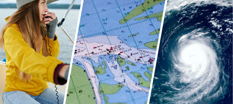
You tell us where and when you'd like to go, and we email, text, or call your detailed vessel-specific weather forecast and routing advice.
Email forecast, phone-in forecast, or text forecast (via cell or sat phone, InReach/Explorer, Zoleo, Spot-X, BivyStick)
We will provide custom forecasts for almost anywhere worldwide, with the exception of the Arctic, Antarctic, Somalia, Gulf of Aden, and the Red Sea. We provide custom forecasts for almost any routing, ranging from short coastal trips to long offshore crossings, including Trans-Atlantic and Trans-Pacific trips.
Typical 5-day forecast:
- Synopsis of major weather features
- Sea Surface Current analysis & suggested waypoints based on sea surface currents
- Detailed forecast for your expected location at 12-hr intervals (shorter intervals during expected significant weather events) for the next 5-7 days, then a general outlook to 10 days, if applicable.
- Detailed forecast includes:
- Date/time and expected location
- Wind speed & direction
- Sea State forecast, including height, direction, and interval of wind-driven seas, as well as swells when applicable.
- Precipitation forecast, including expected wind in squalls
- Tactical advice (such as sail as close a reach as is possible, in order to stay N of 32N).
Typical 10-day outlook: Only a general weather outlook and general weather-based advice over the next 10-15 days. This is optimal for vessels monitoring long-range weather patterns for an upcoming trip, or Trans-Atlantic vessels in settled weather patterns looking to position themselves at an appropriate latitude for trade winds.
Standard Service Rates
10-day General Outlook
2-day Detailed Forecast
Departure advice
Phone-in forecast
10-day General Outlook
2-day Detailed Forecast
On-demand Webcast
Weather Monitoring
5-day Detailed Forecast with 10-day Outlook
5-day Detailed Forecast with 10-day Outlook
Let's look at the Sea Surface Currents 1st:
I'd look for a GulfStream Entry near 34-10N/76-10W.
Direction of GulfStream flow here is 045T...I suggest aiming the boat SE (135T)...but your COG (Course Over Ground) may be closer to 120T across the Stream. Stream is about 40mi wide.
After exiting GulfStream, I'd continue to a WAYPOINT near 33N/74-40W.
There's a clockwise-rotating eddy centered 32-45N/74-50W...you want to pass N&E of this , and the above WAYPOINT should do nicely.
Then turn more SSE...and enjoy a S-flowing current of up-to-2k to a WAYPOINT 31N/74W.
* *
Weather forecast has changed some over past few days...with much more upper-air support for the ColdFRONT exiting US E Coast late Tue16...and that means much-stronger & more due-South wind late Tue16.
SW-WSW wind moderates Wed17 as ColdFRONT nearly-stalls & weakens NW of you.
You'll get another shot of W wind Thu18 when a 2nd FRONT merges with the 1st FRONT & drives the whole mess toward you.
FRONT loses upper-air support again & you see lighter W wind Fri19...then HI pressure in E US finally presses weak ColdFRONT past you about Sat20, and NE Trades establish.
ColdFRONT & associated winds Tue16-Wed17 will be MUCH stronger the farther N you lie. Therefore, your mail goal from Sun14-Tue16 should be to get as far S as possible. The last WAYPOINT I above (31N/74W) is about 280mi SSE of BeaufortNC, and it would be good if you reached this point early Tue16.
As soon as SSE-S wind is strong-enough to sail on Tue16, you can probably begin sailing on as close a reach as you can sail fast, to the ESE-SE...and continue that tactic (as close a reach as is comfortable, generally to the ESE) thru Wed17 morning.
The rest of the trip should be relatively-easy...continue ESE until you've made sufficient East-ing, then turn SSE-S for your destination.
Here's the forecast:
Sun14, morning, departing BeaufortNC: N@10 in the morning, becoming W-N under 10k...you're motoring.
Sun14 night, near GulfStream: NNW@5-10...you're motoring. SWELL 10'/12sec from ENE.
Mon15 morning, SE of GulfStream: L&V...you're motoring. SWELL 8'/10sec from ENE.
Mon15 evening, near 32N/74-30W: L&V...still motoring. SWELL 7'/9sec from ENE.
Tue16 morning, near 31N/74W: 160@5-10...still motoring, but you may want to begin motor-sailing to the SE. SWELL 6-7'/9sec form ENE.
Tue16 afternoon, near 30N/73W: 150@10 building to 15k...you're sailing ESE on a CLOSE reach. SWELL similar...wind-chop builds to 4'.
Tue16 night, near 30N/72-30W: 170@20-25G30...you're sailing ENE-ESE on as close a reach as is comfortable. SWELL may remain 6'/9sec from ENE, but wind-chop builds to 6-9' from S.
Wed17 morning, near 30N/71W: 180@20G25...you're sailing E-ESE on as close a reach as is comfortable. SWELL same. Wind-chop moderates to 6-8'.
Wed17 afternoon, near 29-45N/70-30W: clocking SW@15...you're sailing easily on a reach to the ESE. SWELL same. Wind-chop 4'.
Wed17 night, near 29-30N/69-30W: SW-clocking-WSW@15...same tactics. SWELL may become N. Wind-chop 4' from SW.
Thu18 morning, near 29N/68-30W: 260@12...you're sailing ESE on a broad reach. 5'/10sec NE swell, with 3' wind-chop from W.
Thu18 evening, near 28-30N/67-30W: 250@15-20, isolated squalls to 30k...same tactics. Same NE swell, with wind-chop building 4-6'.
Fri19, near 27-30N/66W: wind may clock W-N@10-20...you jibe & sail something SE-S. Swell 4-5'/10sec from NNE, with 3-6' wind-chop.
Sat20, near 25N/64W: NE@20-25G30, mild squalls may cause persistent 30k wind...you're sailing S (or SSE or SSW) on a broad reach. Seas 6-10'.
Sun21, near 23N/63W: ENE@20-25...same tactics. Seas 6-8'.
Mon22-Tue23 may be similar ENE@20+/-, seas 6-8'.
In summary...get as far SSE as you can (past 31N/74W if you can) before winds begin building Tue16. Then feel free to adjust your course for comfort & speed, but generally head E in the strong S winds late Tue16 into Wed17 morning...then somewhat ESE-SE later Wed17-Sat20.
Try to make nearly all of your East-ing by the time the ColdFRONT passes you Sat20.
Cheers...Chris.
Title of Webcast / SSB Explainer Video Here
00:00 / 00:00
How It Works
Tell Us Where You Want to Go.
Choose 2-Day, 5-Day, Extended ...
We call, text or email weather and routing.
Plans & Pricing
Single-Service
Custom Forecast Credits
Service Combos
BEST VALUE Swipe to Browse
The Complete Package

Webcasts/SSB Radio + Forecast Credits

Regional Email + Forecast Credits
Lorem ipsum dolor sit amet, consectetur adipiscing elit. Cras habitasse nibh urna odio interdum iaculis faucibus. Mauris quis in molestie blandit. At cursus pellentesque dolor a senectus. Vulputate volutpat interdum tristique at convallis nibh quam quis. Sed ut tristique nisl, proin pellentesque velit gravida arcu. Condimentum netus arcu sit urna amet id vulputate.
Lorem ipsum dolor sit amet, consectetur adipiscing elit. Cras habitasse nibh urna odio interdum iaculis faucibus. Mauris quis in molestie blandit. At cursus pellentesque dolor a senectus. Vulputate volutpat interdum tristique at convallis nibh quam quis. Sed ut tristique nisl, proin pellentesque velit gravida arcu. Condimentum netus arcu sit urna amet id vulputate.
Lorem ipsum dolor sit amet, consectetur adipiscing elit. Cras habitasse nibh urna odio interdum iaculis faucibus. Mauris quis in molestie blandit. At cursus pellentesque dolor a senectus. Vulputate volutpat interdum tristique at convallis nibh quam quis. Sed ut tristique nisl, proin pellentesque velit gravida arcu. Condimentum netus arcu sit urna amet id vulputate.